We Bought It to Scratch It: Off Sherman Pass in the Sequoia National Forest
Three nights dispersed at 7,600 feet on the Kern Plateau — quad trails straight out of camp, a fuel-planning lesson, and the Caravan's first scratches.
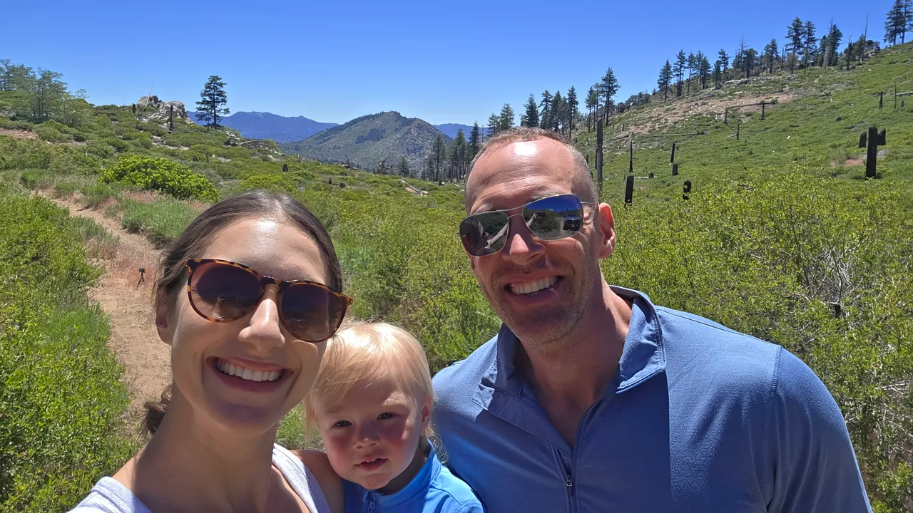
We took the Caravan up onto the Kern Plateau in the Sequoia National Forest. Just Monica, Asher, and me on this one. We stayed at camp for 3 nights.
Two things defined this trip. The first is that I had the new Polaris Sportsman 570 along, and I spent most of the weekend on it with a GoPro bolted to the front. The second is that I pulled the Caravan down a trail it had no business being on and put a scratch down the side of it. I’m not burying that one at the bottom of the post. It’s the whole point, and I’ll get to why.
The Route
We took the southern way around. CA-58 east out of Bakersfield over Tehachapi to Mojave, then north on CA-14 through Red Rock Canyon, then onto US-395 north. A couple of miles past Pearsonville there’s a sign for Kennedy Meadows. That left turn onto Nine Mile Canyon Road (J41) is where the trip actually starts. Roughly 145 miles door to camp, and about 3.5 hours behind the wheel with the trailer.
On paper that’s a lot more mileage than cutting through Kernville and coming over the top from the west. What you get in exchange is divided highway and expressway for most of it instead of a twisty two-lane through the Kern River Canyon.
Nine Mile Canyon Road is the climb, and it earns the description. It’s about 25 miles from the turnoff up to the Y intersection, and much of it is one long sustained grade with sections running up to 10 percent. Paved the whole way, but there’s no shade, no water, and real drop-offs off the canyon edge. You top out at an unnamed pass on the Sierra Crest right at the county line, drop into the Kern watershed, and from there the road changes names twice on you. Kennedy Meadows Road first, then Sherman Pass Road (Forest Route 22S05). Same corridor, three different signs.
Call it 33 to 34 miles from 395 to camp, and you gain a few thousand feet doing it. Camp sits at about 7,600 feet.
The truck didn’t blink at it. No struggle, no heat, no drama pulling the Caravan up that grade. What it did do was drink. Fuel economy fell off a cliff and I burned through a surprising amount of DEF on the way up. That’s not a complaint about the truck, it’s just the arithmetic of hauling a loaded trailer up 4,000 feet of sustained climb, and it’s the kind of thing worth knowing before you’re doing the math on the side of a mountain.
One thing worth clearing up, since I called it Sherman Pass in the video. Sherman Pass itself is the 9,200 foot summit that ranks as the third highest highway pass in California, and it sits west of camp. Coming in from this side, you never cross it. You’re on the road that carries its name, not over the pass.
Last reliable fuel is Pearsonville on 395. The general store at Kennedy Meadows sometimes has fuel and sometimes doesn’t, so don’t build a plan around it. The whole corridor closes in winter for snow and typically opens back up in late May or early June.
The Campsite
Base camp: 36.0614, -118.23082
We camped dispersed off Sherman Pass Road at about 7,600 feet, sitting roughly half a mile south of Troy Meadow Campground and about three quarters of a mile northwest of Fish Creek Campground. Both of those are developed, first-come-first-served, with vault toilets and a fee. We weren’t in either one.
What made the spot work was the access. There’s pavement right there at camp. One straight trail runs from camp out to the main road, and then it’s about a minute on the pavement before the trailhead veers off slightly to the right. It’s signed, and the trail itself is as wide as a road, so there’s no hunting for it. A short way down there’s an open area big enough to hold several large RVs. There were three parked in it the weekend we stayed, so it’s no secret.
Weather was 70 degrees and nobody was around at any of the spots I rode out to.
Trail waypoints, because nobody ever posts these and it drives me nuts:
- 36.03586, -118.23903 (my favorite)
- 36.04074, -118.22346
- 36.04385, -118.21201
- 36.02927, -118.21788
What to know before you go: no water, no trash service, pack out everything you bring in. Stay limit is 14 days in any 30-day period. Fire permits are required. Cell service is effectively nonexistent up there, so download your maps at the bottom of the hill. And if you’d rather have a developed site, Troy Meadow and Fish Creek are the only two campgrounds on the plateau that allow OHV use, which matters a lot if you’re hauling a quad like we were.
What Worked
Camp had pavement out front and a trail out the back. This was the single best thing about the spot. Getting from the Caravan to the trail system took about a minute and required zero planning. No trailering the quad, no staging, no deciding whether it was worth the hassle.
The Sportsman earned its spot immediately. The 2026 Sportsman 570 40th Anniversary edition did everything I asked of it and most of the video is footage from it. Mounting the GoPro on the front was the right call. That angle makes the trail look like what it feels like instead of what it looks like from a chase vehicle.
None of it required a built rig. Every trail we ran up there is doable in a stock pickup with four-wheel drive. No lift, no lockers, no fully optioned Jeep. I want to be clear about that because a lot of channels make this look like it takes fifteen grand in modifications to get off pavement. It doesn’t.
Engine noise is a toddler off switch. Monica took Asher around camp on the four-wheeler at maybe three miles an hour and the kid was out cold. Something about engines does it to him every single time. Filing that one away permanently.
We marked waypoints as we went instead of after. I’ve complained plenty about videos that show you a gorgeous overlook and then never tell you where it is. Dropping pins in OnX in the moment meant the coordinates above are real and not reconstructed from memory a week later.
What Didn’t
I went up the mountain without a full tank of diesel. This is the one I’m most annoyed about, because it was pure planning and it cost us real time. The climb ate fuel at a rate I should have anticipated, and once we were at camp I didn’t have enough left to run the truck around the trails the way I intended. So I drove back down the mountain to fill up and then drove back. I filled up at the Shell station at the base of the mountain right off 395. Nothing broke, nothing went wrong, I just didn’t think it through. The rule going forward is simple: full tank before I leave the highway, every time, and especially when the plan includes putting miles on the truck off pavement.
I took the Caravan down a trail to set up camp that was a bit too narrow. Brush and trees on both sides, and the trailer came home with a few scratches down the length of it. Could I have found a better camp to set up camp, maybe. But I’m okay with the decision we made.
Three trails in a row had trees down across them. Before that, three more were closed outright. We ended up pushing north before we found anything open. That’s a normal part of driving in a national forest and I expected some of it, but six dead ends before the first clean run is a lot of daylight spent on turnarounds. Calling the Kern River Ranger District ahead of time probably would have saved some of it: 760-376-3781.
What We Filmed
Video’s at the top. It’s mostly four-wheeler footage from the GoPro on the front of the Sportsman, plus a chunk of truck b-roll, a walkthrough of the map with camp and the waypoints marked, and the drive up Sherman Pass so you can see what you’re getting into before you commit a trailer to it.
Honest note on the edit: I had so much quad footage that picking clips was the hard part, not finding them. The full set would have run three hours and nobody’s watching that, so what’s in there is one favorite trail and the highlights. The truck segment includes the fallen trees, because that’s the actual experience of driving out there and cutting it would have been dishonest.
Off the Trail
I said something in the video about a minute in that I want to put down here in plain text, because it’s the closest thing I have to a thesis.
I buy the equipment to take it off road. To get it scratched. To get it dirty. As long as the mechanics work the way they’re supposed to, I’m not worried about their aesthetics.
That’s easy to say into a camera. It costs something the day you’re looking at a fresh stripe down the side of a trailer you just bought.
I want to be clear that I’m not reckless with my stuff. I try to prevent damage. I pick lines, I walk what I should walk, and I got this one wrong. But there’s a real difference between taking care of your equipment and letting the fear of a scratch decide where you’re willing to take it. The second one is how a trailer ends up sitting in a driveway for ten years looking brand new and going nowhere.
I know it sounds cliche. You really do only get to do this whole living thing once. I’m not interested in spending it protecting paint, and I’m definitely not interested in being so wound up about a scrape that it shrinks the map of where we’re willing to go. The scratch is the toll. I’d rather pay it than stay home.
Notes for Next Time
- Call the Kern River Ranger District before committing to a trail plan. Half the routes near camp were closed and we burned real daylight finding that out one at a time.
- Leave the Caravan at camp. It’s a base, not a trail rig. The truck exists for a reason.
- The corridor closes in winter and typically opens late May or early June. Late spring through fall only.
- Top off in Pearsonville. Don’t count on the Kennedy Meadows store having fuel.
- Full tank of diesel before leaving the highway. Not a top-off, full. The climb eats more than you’d think and there is nothing to buy once you’re up there. Same goes for DEF.
- The 58 to 14 to 395 approach is longer in miles but mostly divided highway. Worth it with the trailer. The Kernville approach is the shorter, twistier alternative if we ever want the other half of the loop.
- Download maps before leaving pavement. No cell service up there.
- Give day one a lighter workload. 150 feet of walking at 7,600 feet was enough to leave me out of breath.
- Troy Meadow and Fish Creek are the OHV-friendly developed campgrounds if we ever want toilets and a fee site instead of dispersed.
- Bring the four-wheeler on every trip Asher is on. Three miles an hour around camp is a guaranteed nap.